
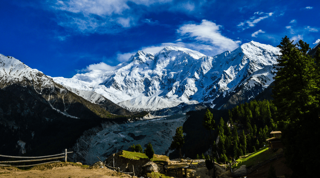
Nanga Parbat 26,660 high located in the Himalaya in Kashmir. It is the 6th highest mountain in the world.
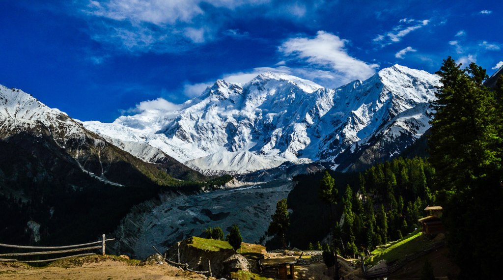
Nanga Parbat, also called Diamir, one of the world’s tallest mountains, 26,660 feet (8,126 meters) high, situated in the western Himalayas 17 miles (27 km) west-southwest of Astor, in the Pakistani-administered sector of the Kashmir region. The Himalayas has some of the Earth’s highest peaks, including the highest, Mount Everest and more than 100 peaks exceeding elevations of 7,200 m (23,600 ft) above sea level. The range abuts across five countries: Nepal, China, Pakistan, Bhutan and India. The sovereignty of the range in the Kashmir region is disputed among India, Pakistan, and China. The mountain’s steep south wall rises nearly 15,000 feet (4,600 meters) above the valley immediately below, and the north side drops about 23,000 feet (7,000 meters) to the Indus River.
Towering immediately southeast of the northernmost bend of the Indus River in the Gilgit-Baltistan region of Kashmir, Nanga Parbat is the westernmost major peak of the Himalayas, and is nearby the Indus and Yarlung Tsangpo/Brahmaputra rivers, it is the western anchor of the entire mountain range. Nanga Parbat is one of the 14 eight-thousanders.
An immense, dramatic peak rising far above its surrounding terrain, Nanga Parbat is known to be a difficult climb, and has earned the nickname Killer Mountain for its high number of climber fatalities. The most recent death was in July of 2023, a Polish climber, Pawel Tomasz Kopec had suffered breathing problems while descending the 8,126-meter (26,660-foot) mountain with two other climbers in harsh weather conditions. Authorities said two other mountaineers were safe and returning to their base camp.
The British Alpine climber Albert F. Mummery led the first attempt to ascend the glacier- and snow-covered mountain in 1895, but he died in the attempt. At least 30 more climbers (mostly German-led) also perished on Nanga Parbat because of the severe weather conditions and frequent avalanches before the Austrian climber Hermann Buhl ascended in 1953. The Kashmiri name Nanga Parbat is derived from the Sanskrit words nagna parvata, meaning “naked mountain.” Diamir is a local name for the peak and means “king of the mountains.”
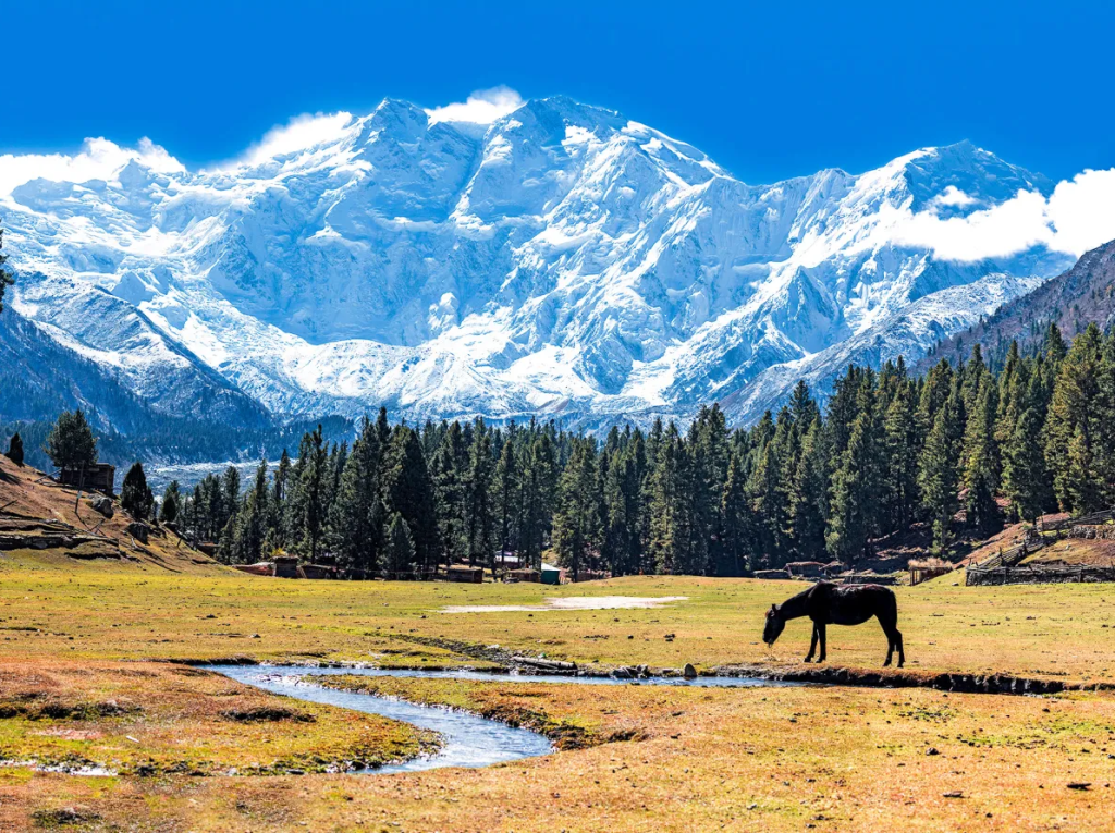
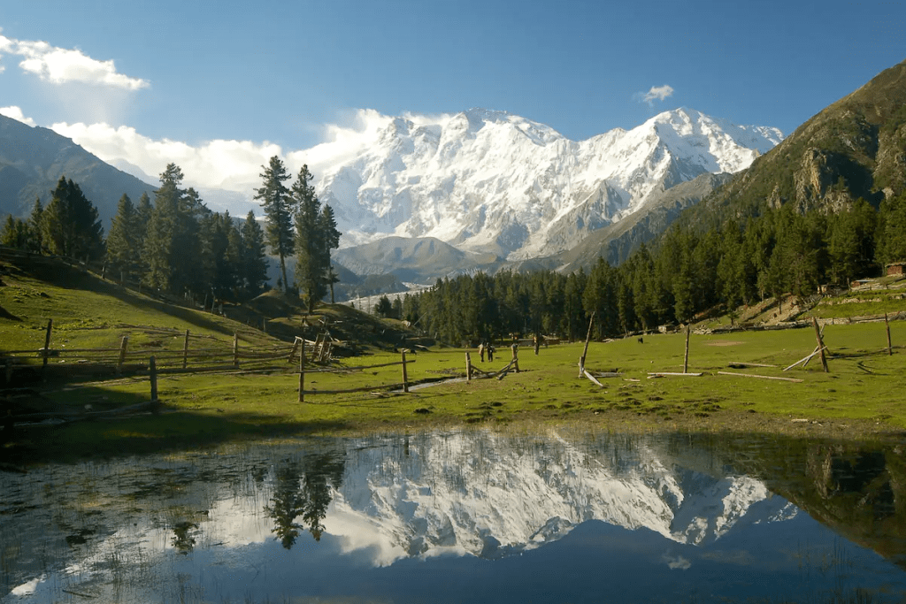
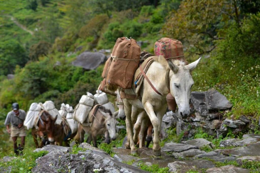
Fairy Meadows
Fairy Meadows, named by German climbers “fairy tale meadows” and locally known as Joot, is a grassland near the base camp site of the Nanga Parbat. Located in Diamer District, Gilgit-Baltistan, Pakistan and at an altitude of about 3,300 meters (10,800 ft) above sea level. It serves as the launching point for trekkers summiting on the Rakhiot face of the Nanga Parbat. In 1995, the Government of Pakistan declared Fairy Meadows a National Park.
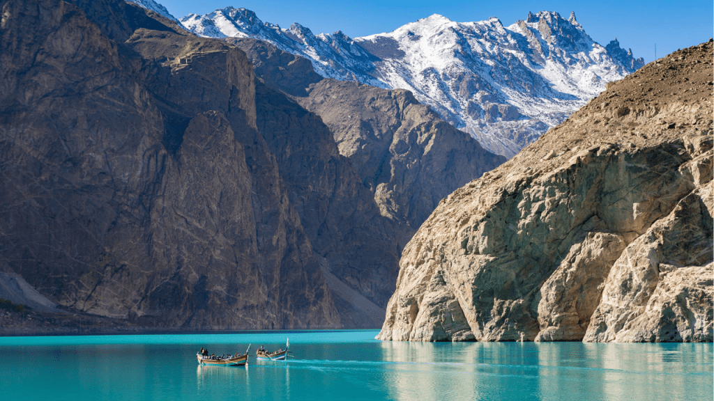
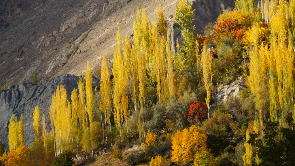
Hunza Valley
The Hunza Valley is a mountainous valley in the northern part of the Gilgit-Baltistan region of Pakistan. It is located alongside the Hunza River. The valley shares its borders with Ishkoman to the northwest, Shigar to the southeast, Afghanistan’s Wakhan Corridor to the north, and the Xinjiang region of China to the northeast. The Hunza Valley floor is at an elevation of 2,438 meters (7,999 feet). The Hunza Valley consists of three regions: Upper Hunza, Central, and Lower.
Hunza is a popular tourist destination due to its location and climate. Several high peaks are located in the surroundings of Hunza Valley. Khunjerab Pass is a 4,693-meter-high mountain pass in the Karakoram Mountains. It is in a strategic position on the northern border of Pakistan and on the southwest border of China.
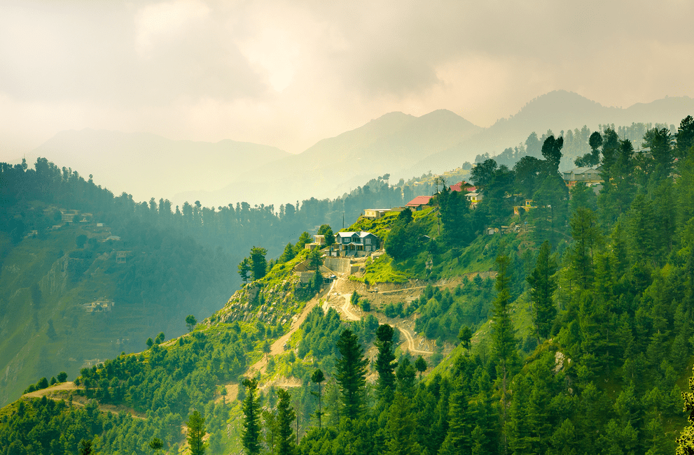
Muree Hills
Murree is a mountain resort city, located in the Galyat region of the Pir Panjal Range, within the Murree District of Punjab, Pakistan. It forms the outskirts of the Islamabad-Rawalpindi metropolitan area, and is about 30 km (19 mi) northeast of Islamabad. It has average altitude of 2,291 metres (7,516 ft). The British built this town during their rule to escape the scorching heat in the plains of Punjab during the summer.
Construction was started in 1851 on the hill of Murree as a sanatorium for British troops. The permanent town of Murree was constructed in 1853 and the church was consecrated shortly thereafter. One main road was established, commonly referred to even in modern times, as the mall. Murree was the summer headquarters of the colonial Punjab Government until 1876 when it was moved to Shimla, the capital and the largest city of the northern Indian state of Himachal Pradesh.
Murree is a popular tourist station for British citizens of the British Raj. Several prominent Britons were born here including Bruce Bairnsfather, Francis Younghusband, Reginald Dyer and Joanna Kelley. During the colonial era, access to commercial establishments was restricted for non-Europeans. Such establishments include Lawrence College, Murree.
Murree has retained its position as a popular hill station, known for its pleasant summer weather. Many tourists from the Islamabad-Rawalpindi area visit the town. The town also serves as a transit point for tourists visiting Azad Kashmir (the western portion of the larger Kashmir region). The town is noted for its Tudorbethan and neo-gothic architecture. The Government of Pakistan owns a summer retreat in Murree, where foreign dignitaries including heads of state often visit.
Recommended Tours
Nanga Parbat Expedition by Trango Adventure
Hunza Valley Sightseeing Tour – Islamabad Territory
Hunza Autumn Tour – by Hunza Explorers
Gallery
Lal Suhanra National Park


Leave a reply to Faizanbijard Cancel reply